| Association régie par la loi 1901-Reconnue d'intérêt Général en mars 2006 |
| | | | | | | | | |
|---|---|---|---|---|---|---|---|---|---|
| Home | History | Location | Orphanage | Schools | Spirulina | Villages | Actions | About us | Became a member |
| Benin, formerly known as Dahomey, is situated on the Gulf of Guinea. It is surrounded by Togo, Burkina-Faso, Niger and Nigeria. |  |
 To
discover wild animals, you must go to the north reserve of Great W,
which stretches over 3 countries: Burkina, Niger and Bénin. To
discover wild animals, you must go to the north reserve of Great W,
which stretches over 3 countries: Burkina, Niger and Bénin. |
This
small country extends 700 km from the Gulf of Guinea to NIGER. From
TOGO in the west to NIGERA in the east, its only 125 Km wide along the
coast, and 325 Km wide at TANGUIETA. With a surface area of
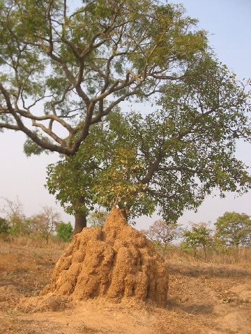
112 622 Km², it has a population of about 7.500.000 inhabitants. Péréré is situated in the department of BORGOU, in blue on the map, up an 80 Km track north of PARAKOU, which is the largest town in the north (120.000 inhabitants). It is a region where the main resource is traditional agriculture:
no donkeys, no oxen and no farm, machines. In the village they rear
pigs, goats and sheep and keep poultry: hens, ducks and
guinea-fowl. Cattle-breeding is the reserve of the FULA. |
 The war memorial, in the centre of Péréré. |  
To enlarge the map |